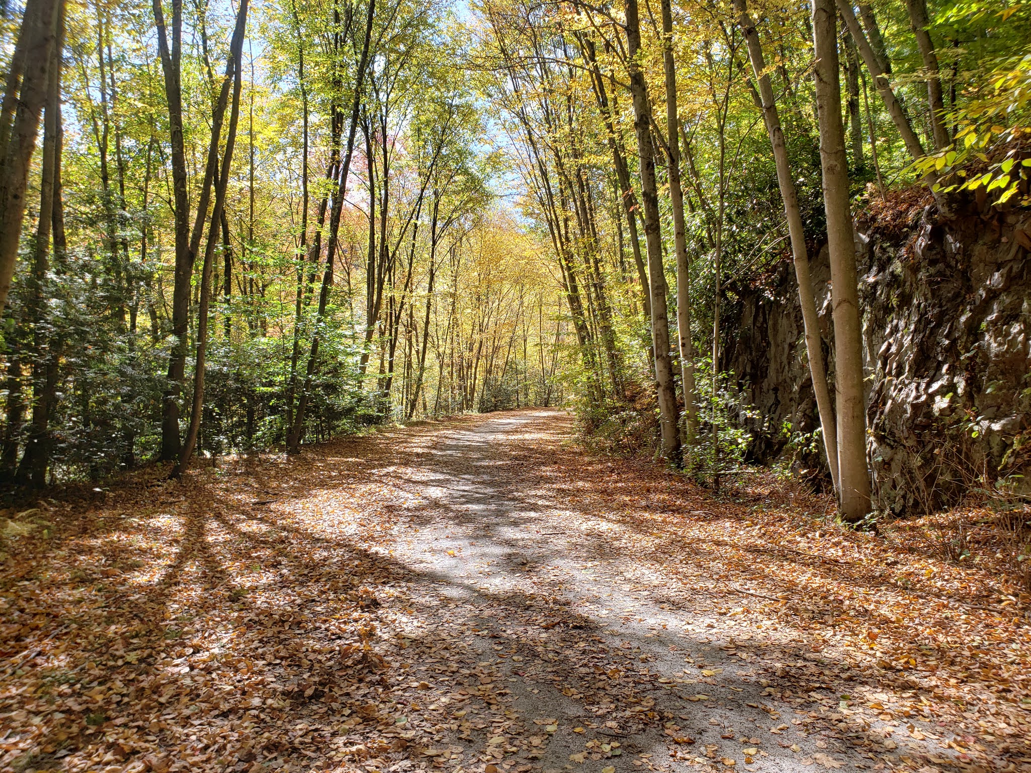
The Karl Stirner Arts Trail or KSAT is a short trail near Lafayette College in Easton, PA. The trail has a mural, sculptures, a landscaped maze, a dog park and a nature trail. The main trail is paved and has a short section on a sidewalk. At around two miles it is not really a cycling trail but it makes a nice change for someone cycling another nearby trail for example the 165 mile D&L.
You can park at a small shared lot at one end 40.6961690366186, -75.22805608039589, located at N 13th St. This is a great trail for kids. There is an app that has trail information. It is called Agents of Discovery. The reviews mentioned kids a lot so I did not try it, My youngest is in his late 30's.
There is a nature trail off the main trail. It is mulch surface so it is a bit more work on a bike but it passes much closer to Bushkill Creek. I have seen deer, geese and turkey on the trail.
The Karl Stirner Arts Trail is part of The Link system of trails.
I consider the D&L my home trail. There are a couple of trails closer to my home but the D&L is only 20 minute drive and I enjoy it more than any other nearby trail. This post is focused on the northern portion of the trail officially called the anthracite region. I am less familiar with the southern end of the trail even though it is a mere 165 miles away.
Jim Thorpe is a small town in eastern
PA along the D&L trail in Carbon County. The town was originally named Ma
Chunk but the name was changed to honor Jim Thorpe the Olympic athlete buried
there. The history of the athlete, and the town is interesting, but I am going
to consider its importance to cycling.
The D&L Trail passes through the historic downtown. The D&L is a rail-trail and portions a rail with trail.
You can board the train to take a scenic ride along the Lehigh River and on
some weekends, you can ride to White Haven with a bike and return on the trail,
about 25 miles. The 25 miles runs through the beautiful and scenic Lehigh
Gorge. The ride is a very gradual downhill the whole way making it a very
popular tourist destination. Some weekends the excursion train is pulled by a steam locomotive, check the railroad website for the schedule. Learn more about the Lehigh Gorge here.
In addition to the railroad, there are
a couple of local outfitters that rent bikes and operate shuttle service for
one way trips. Most people start in White Haven and ride down. You can opt to
go to Mountain Top and ride the Black Diamond portion of the trail north of
White Haven. The Black Diamond is named for the anthracite coal that was once
hauled by trains in the area. Black Diamond does not reflect the difficulty of
the trail but it is just a bit more of a downhill than the gorge. The gorge
averages about 2% and the Black Diamond is 3-4%. The Black Diamond adds about
10 miles to the trip making for a 35 mile ride.
A bridge and short section of trail was
recently completed on the south end of Jim Thorpe allowing easy access to the
southern portion of the D&L Trail. You will pass remnants of the canal on one side
of the trail with the Lehigh River on the other side of the trail.
This takes you to Weisport where the trail continues across the bridge. At the end of the bridge the trail turns right and zig zags down. At the bottom you turn right to go under the bridge and continue toward Bristol. Alternately you can turn left and follow a short spur to the town of Lehighton.
Further south you pass the nature
center before the next trail town of Slatington. The trail continues south to
Northampton. There is a spur trail in Slatington called the Slate Heritage
Trail and another spur in Northampton called the Nor-Bath Trail. The section of
the D&L between Jim Thorpe and Northampton is about 25 miles.
South of Northampton there is a gap in
the trail before it picks up again in Allentown. The trail traverses the Lehigh Valley to Easton. Easton is the location of the confluence of the Lehigh and Delaware Rivers. It is also the location of Hugh Moore Park. This is the headquarters for the heritage corridor and the Canal Museum. Another trail of note in Easton is the Karl Stirner Arts Trail. This trail features sculptures and other art. It is short for cycling but worth a visit. From Easton the D&L Trail continues along the Delaware Canal to Bristol, PA.
This section passes the historic Washington's Crossing (as in George Washington crossing the Delaware). The Delaware and Raritian Canal State Park Trail is on the other side of the Delaware river in this area. Several bridges in the area allow for some nice loop rides.
The trail has mile markers every mile along the entire length. The markers along the Delaware Canal are granite markers at ground level. These are a bit difficult to see. See a picture below. Also some of the highlights of the trail are listed below and may be located by mile marker.
On the northern end, the trail is expected to continue to
Wilkes-Barre. This continuation involves several segments that will take the
trail to Oliver Mills and across to the Seven Tubs nature area. Before meeting
the Wyoming Valley Levee Trail in Wilkes-Barre. One 3 mile section from Oliver
Mills to the Seven Tubs is nearing completion as of this writing. Other
sections are not as far along in the planning and building process.
Once the northern end from Mountain Top
to Wilkes-Barre, PA and the gap between Northampton and Allentown, PA are
complete the trail will about 165 miles. The trail is divided into 3 regions: The Anthracite Region, Lehigh Valley, Delaware Canal. Jim Thorpe is the northern end of the Lehigh Valley region.
Jim Thorpe has several options for
staying overnight and interesting merchants and food options. The train station
serves as the visitor center and has modern restroom available to trail users.
Many weekends include street vendors and entertainment in front of the visitor
center. There is plenty of parking near the visitor center but you must pay at
a kiosk or via an app called flowbird. This area is generally quite busy with trail users,
people doing white water rafting and other visitors to the town.
There is another trail in Jim Thorpe
called the Switchback trail. This trail was home to a rail line that carried
passengers on weekends for a wild ride that became the predecessor to the
modern rollercoaster.
A short distance upriver from Jim
Thorpe on the opposite side is an area called Glen Onoko. This is the lower end
of the gorge. It offers hiking and river views along with plenty of free
parking. Jim Thorpe is about 2.5 miles further south on the trail. If you visit
Glen Onoko bring some lights and explore the abandoned train tunnel called the
Turn Hole Tunnel. The tunnel entrance is at 40.88226, -75.76254. The end of the tunnel is a very nice overlook of the river. (UPDATE The tunnel has recently been closed for safety reasons.)
There is another abandoned tunnel at the Rockport trailhead. It is near the end of the last upper parking lot. From the trail, you walk a short distance up the road. The GPS coordinates are 40.96636, -75.75679
If you plan on ridding the Lehigh Gorge and have not been there before, please read important safety information.
As you ride the D&L there are some particularly nice spots for pictures. Don't pass these mile markers without stopping for a picture.
Picture stops
Black Diamond section
135.95 Moosehead Lake
135.85 Beaver Dam
134.35 Concrete Phone Booth
Lehigh Gorge section
128.1 Rambling Run Nice all the time but especially so when the water is running or the mountain laurel are blooming.
125.2 Lock 24 Be very careful here since you need to venture off the trail. The lock itself has high stone walls that are not protected by a fence. Keep a close eye on small children and overconfident teens. Venture a bit further for nice views of the river.
121.25 Buttermilk Falls Take pictures from the bridge or get closer to the falls. Be careful of slippery rocks if you choose the latter.
120.65 Luke's Falls
116.2 River lookout. Don't get too close to the edge.
114.5 Lookout rock. Use your discretion if you are not sure footed.
109.2 Bear Warning Sign. Not nearly as ominous as it sounds. Read Lehigh Gorge safety page if you are concerned.
South of Jim Thorpe
104.4 Observation Platform
103 Bridge to Nowhere
102 - 103.8 Weisport Canal. No specific place but the water in the canal is usually still enough to give nice reflections making for good pictures.
58.9 Easton, the confluence of the Lehigh and Delaware rivers along with a small dam at the end of the Lehigh make for some interesting shots.
Many riders in the Lehigh Gorge section
of the D&L trail ride downhill from White Haven to Jim Thorpe. It is easy
to forget that some riders ride up the trail. This makes it very important to
keep to the right on the trail. I see many cyclists riding two abreast and having
a conversation. The distraction is as dangerous as if they were driving. I have
been forced off the trail more than once by people riding in this manner and
not hearing my alert.
Don’t forget this trail traverses a
forested area without corner stores for food or water. Be sure to carry enough.
Remember pedaling is exercise. You will sweat and need to replace fluids and you
will develop an appetite.
The trail itself is safe if you stay on
the trail and pay attention. An unexpected hole or rut can throw a cyclist that
is not paying attention. If you venture off the trail you may encounter
wildlife. Grass or bush adjacent to the trail may harbor ticks. Be sure to
check yourself and your family after a ride.
Another threat off the trail is snakes.
Most people that ride the trail never see a snake. If you do see a snake it is
often a black rat snake the is very docile and not venomous. If you step off
the trail there is a small chance of encountering a venomous rattle snake.
These snakes are also docile and will not bother you unless you bother it. A
few years ago, I stepped a few feet off the trail in some ankle high grass. I
froze when I heard a distinctive rattle. I almost stepped on a rattle snake. I
did not get bit but was reminded to stay on the trail.
The area is also home to black bear.
Black bear generally stay away from people and it is rare to see one on the
trail. I ride the trail 30-40 times in a year and may see one every other year.
They generally ignore people and are not dangerous. The exception is mama bears
with cubs. Mamas are very protective of their cubs. Never get between a mama
bear and her cubs. If you see cubs, you can be sure mama is not far away. Stay
away from the cubs no matter how cute they look. This is mostly an issue in the
spring when the cubs are still small.
Also remember the trail is somewhat
remote in parts. That means you will not have cell service for most of the
trail. A few places have spotty service. If you need help it will likely come
from fellow cyclists. If you see someone stopped, ask if everything is ok. The
next time it may be you that needs help.
The Torrey Brown is a 20 mile
rail-trail between the PA-MD line and Hunt Valley, MD, just north of Baltimore.
The trail was originally called the NCR Trail (Northern Central Railroad) and
you may still see signs and other references to the NCR name. The northern end
of the trail connects to the York Heritage Trail in PA near New Freedom, PA. The trail is one segment of the East Coast Greenway.
Most of the trail runs along Gunpowder River and is part of Gunpowder Falls State Park. The usual hiking, jogging and cycling users are often seen. It should be noted that the trail is open to horseback ridding but I have not seen anyone doing so in the few times I have ridden it.
As with most trails, the Torrey Brown is equipped with mile markers, stop signs at road crossings, porta potties, picnic tables and so forth. Class 1 e-bikes are permitted. The trail is open sunrise to sunset.
The Mason-Dixon line (PA-MD boarder) is
the highest elevation for the trail. It is a gradual downhill from there to
Hunt Valley. The combination of this trail with the York Heritage Trail is part
of the Rail-Trail Hall of Fame.
The trail surface well packed dirt or crushed limestone. It is all hard packed and has very few low spots for water to accumulate. I used my hybrid with 40mm tires and felt very comfortable. I am sure a road bike would be fine but it would not be my first choice.
More information about the trail may be found on the Gunpowder Falls State Park webpage. Here is a Google map with elevation profile.
You may see rectangles painted with purple paint along the trails. In Pennsylvania and many other states this means NO TRESPASSING. This is equivalent to posting signs that say no trespassing. Please be respectful of land owner's wishes and stay on the trail.