Dawkins Line Rail Trail

 I rode the Dawkins Line Trail in mid-April of 2025. I started at the Jenny's Creek Trailhead (37.78504, -82.83653) and headed west. Jenny's Creek trailhead has a lower elevation than the Tip Top Tunnel so I would have more downhill on the way back. The paved trail is composed of two sections, a 25 mile segment and an 11 mile segment separated by the Tip Top Tunnel that is closed. The section that I rode is the 25 mile section but starting at Jenny's Creek skipped about three miles on the east end. My round trip mileage total was 44.7 miles.

Within just a few miles I encountered menacing dogs chasing me four different times. Two instances were individual dogs and the other two times it was packs of dogs! Three of the times I heard or saw the dogs and got a boost of adrenalin and was able to speed away. I have no illusions that I was fast enough to do this rather the dogs gave up easily despite barking, snarling and growling. The dogs did not give up so easily in one instance and this was a pack of at least five dogs. I was able to retrieve my water bottle and spray my water at the dogs. This fortunately stopped the dogs in their tracks. The rest of the way out I had no more issues with dogs. The unease from the encounters was distracting, making it difficult to enjoy the trail.

At the western end of the 25 mile segment the trail abruptly ended. There was a very rough gravel road that I attempted to follow to get a look at the closed tunnel. That road quickly turned impassable with washed out gullies that looked difficult to hike and certainly impossible to ride. I turned around without a glimpse of the tunnel.

The return trip was filled with anxiety of knowing I need to pass the dogs to get back to my car. On the way out I had no issues with dogs on the western portion of the ride but that changed on the return. There was one part of the trail high above several houses. A very steep cliff along side the trail dropped to the back yards of the houses. The cliff seemed to be about three times taller than the houses. Near one of the houses was a lady in the front yard with two dogs. The dogs saw me and started barking. I was reassured by the cliff between the trail and the dogs. That reassurance was short lived as on of the dogs rapidly climbed the cliff and appeared next to the trail. Fortunately, I think climbing the cliff tired the dog, I was chased but it was short and half hearted. 

As I approached the part of the trail where I had the dogs chase me on the way out I held my open water bottle at the ready. It turned out not to be needed. I had no more dog encounters. These dog incidents ruined the experience and once at the car I had no desire to check out the three mile section of trail to the east of the car that I didn't ride.   


Washed out road to the Tip Top Tunnel


Gun Creek Tunnel


Prestonsburg Passage Rail Trail

 Prestonburg Passage is a short, 8.5 mile rail-trail in Kentucky. It is paved surface with a mix of wooded, residential and other landscapes. I found it to be a very pleasant ride. The most distinctive feature is the school bus bridge. This is a short bridge with the body of a school bus placed on top allowing trails users to pass through the bus. I think it is a very creative touch.

I rode the trail in mid-April of 2025. I started in Archer Park where crews had part of the park closed for flood cleanup. A couple of miles into the ride I encountered a large tree across the trail. I was not sure who to report this to so I just scooted under the tree and continued to ride. I soon found a rest area including a bench, picnic table, trash can, bike rack and porta potty all beneath a highway bridge. When I returned, I found the tree completely cleared and the park cleaned up and reopened. Kudos to the crew.

The school bus bridge is located at 37.61181, -82.84758. Notice in the pictures the numerous trash cans along the trail. In my experience this is unusual. Most trails are carry in, carry out.


Mon River Rail-Trail

 In mid-April 2025 I started a ride on the Mon River Trail by way of the MCTrail (Marion County Trail), a 2.5 mile spur that connects to the main Mon River Trail. I parked at the trailhead for the McTrail (39.51735, -80.09564) and proceeded through a short, well light tunnel and continued mostly downhill to Prickett's Fort. This is not just an area name but an actual historic fort. I suggest using the rest rooms at the fort since there are no other facilities until you reach Morgantown, about 19 miles away.

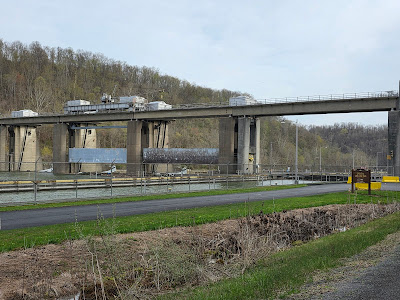
Once on the main trail it was flat and had a crushed stone surface that was easy to ride on. There I had almost continuous views of the Monongahela river. There were mile markers every mile. I passed a couple of lock/dam structures on the river (39.56325, -80.05022), (39.58362, -80.01023). Almost the entire distance to Morgantown it was just the forest and the river and felt like a vacation from civilization. Occasional glimpses of water cascading down the mountain broke any monotony. 

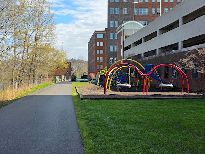
Once at Morgantown it changed into a modern riverfront greenway with businesses, art, comfort stations, monuments and everything would you expect in a college town. The elevated Personal Rapid Transit was interesting as it ran overhead, paralleling the river. The greenway was a paved surface.

As I continued north the trail reverted back to the natural environment I enjoyed south of the city. Another 6-7 miles north of the city is the Pennsylvania/West Virginia line. Once you cross the line the trail name becomes the Sheepskin Trail. This trail is just a couple of segments now but will eventually connect to the Great Allegany Passage.

The day I rode the weather was blustery with significant wind gusts. Added to the mix was occasional rain showers. Twice during the ride I stopped at a shelter on the trail to wait for the rain to ease up. The trail was well worth enduring the weather. I can see why this is a Hall of Fame Trail. My 32.5 mile ride gave me 65 miles round trip.


Waiting for rain to stop


Carter Cemetary


Pricketts Fort