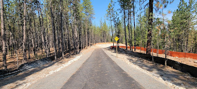
Centennial Trail

The Centennial Trail is a 63 mile paved trail in eastern Washington state and Idaho. This is NOT a rail-trail. Portions of the trail are on road and some sections have moderate climbs. The good news is that the trail is paved. About 38 miles are in Washington state and another 24 miles are in Idaho.

The Centennial Trail has been designated a National Recreation Trail. In Washington, the trail is managed as Centennial Trail State Park but individual jurisdictions maintain the trail. You may see the Washington state section listed as Spokane River Centennial State Park Trail to differentiate it from similarly named trails. The Idaho section is called North Idaho Centennial Trail.

Cyclists planning to ride the destination trails of Coeur d'Alene or Hiawatha often ride this trail from Spokane into Idaho and the city of Coeur d'Alene. The ride is about 40 miles. My GPS app showed almost 1100 feet of elevation gain from Spokane to Coeur d'Alene. 

I rode here in September 2021. The scenery was spectacular. The shaded portions of the ride were very peaceful. Some areas had great overlooks with views of the Spokane River. One day I did an out and back from Spokane to Nine Mile Recreation Area. The next day it was a one way from Spokane, WA to Coeur d'Alene, ID.

The urban portions of the trail in Spokane's Riverfront Park and Gonzaga University were beautiful. Sculptures and other public art are mixed with manicured landscaping compliment the natural waterfalls along the river. This is the nicest urban trail that I have ridden.

A Discover Pass is required to park at trailheads within Riverside State Park, WA.

For more information check out:

Friends of the Centennial Trail

Spokane County Parks, Recreation & Golf

City of Coeur d'Alene

Washington State Parks


A portion of my ride on this trail may be found on my YouTube channel.


Riverfront Park:


Path of the Flood

This trail is exactly what the name says. The trail follows the path of the historic Johnstown, PA flood of 1889. The trail begins just below the South Fork Dam, the dam that breached causing the flood. The trail then, 12 miles later ends at the Johnstown Flood Museum. Portions of the route are dedicated trail and some portions are on street. The trail is considered a rail-trail but there are some challenging inclines.

The trail "is paired with" the Staple Bend Tunnel Trail. I am not sure what that means. It doesn't seem likely that the tunnel was actually in the path of the flood waters. Looking at a map it seems the trail detours to the tunnel then returns to a what I assume was the actual path of the floodwaters.

The two mile trail to reach the tunnel and the 901 foot tunnel are operated by the National Park Service. The Staple Bend Tunnel is the first railroad tunnel built in the United States. The trail is part of the Allegheny Trail System and the September 11th National Memorial Trail. The South Fork Dam breach and resulting flood claimed 2,200 lives. For comparison, the World Trade Center collapse on 9/11 claimed 2,606 lives.

I rode the trail from the Fifficktown Trailhead (40.36834, -78.79218) to the tunnel in September 2021. My GPS indicated an elevation gain of 379 feet for my ride. The first half I thought was unremarkable and did not like the on road portion to connect to the tunnel trail. The route includes a one lane underpass with a blind curve. There was a traffic signal but I still felt uncomfortable. The tunnel trail portion was very nice. Mile markers seemed to start at the tunnel trailhead. I did not notice any on the first portion of my ride. The only comfort station I noticed on my ride was a permeant one located at the tunnel trail trailhead. 

More information about the trail may be found on the websites of:

Cambria County Conservation & Recreation Authority 

Trans Allegheny Trails

PA DCNR 

National Park Service Audio Tour

A video of my ride in the tunnel is included on my YouTube channel.


Clarion - Little Toby

The Clarion - Little Toby Trail runs from Ridgway to Brockway, PA. This rail-trail is 18 miles of packed dirt/crushed stone. I found mile markers every mile.

I rode this trail in September 2021. I started in Taylor Memorial Park in Brockway at MM 18. I turned around at MM 10, just north of the Swinging Bridge (MM 12.2). In that distance my GPS app showed an elevation gain of just 74 feet. The segment I rode was very smooth and almost entirely shaded. I enjoyed this trail and hope to return some day to ride the remaining portion. This segment runs adjacent to the Little Toby Creek. The section I did not ride parallels the Clarion River.

I didn't see any comfort facilities but the trailhead in Brockway is adjacent to a park and athletic fields. Seems there would be facilities there but I didn't specifically search.

I did not see any other people on the trail but I was riding midweek during the day. I was a bit surprised I didn't see any notable wildlife. That would have been understandable if there were more people but riding solo I generally see some wildlife activity.

Important note: E-bikes are NOT permitted on this trail.

For more information visit these websites:

Pennsylvania Great Outdoors Visitors Bureau

Pennsylvania Wilds

PA DCNR

Tricounty Rails to Trails


Here is a video of my ride: