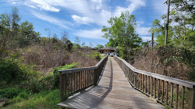
Allegheny River Trail


This 30 mile, paved trail begins in Franklin, PA at 41.38688, -79.81754. The trail meets the Samuel Justus Trail at this location. Along the trail are nice views of the Allegheny River. There are two tunnels along the trail and you will need lights for each.

The trail is paved except for a short section that veers away from the old rail bed into a small community. Here the surface is dirt and loose gravel that is shared with local residents. There were numerous benches offering a peaceful resting spot to watch to river flow, possibly with wildlife. 

To learn more visit the website for the trail or DCNR's website


Redbank Valley Trail


The Redbank Valley Trail is an under appreciated gem of a trail in western Pennsylvania. This 40 plus mile trail has a crushed stone surface that was smooth to ride. I started at 40.99559, -79.49019 where there was parking and a porta potty. I rode about 15 miles into New Bethlehem where I stopped at a convinence store for a snack and to refill my water supply. Along the way were some very nice art sculptures and two tunnels. If you ride this section of trail, you will need lights for the tunnels.

The trail is away from civilization so don't expect cell coverage. As with most rail-trails the trail was basically flat. One interesting feature is Ray's Place. This is located at the end of the Long Point Tunnel (40.98311, -79.45528) and was built as a tribute to a long time trail advocate from the area. It includes a lean-to for bike packers to bunk for a night along with a permanent drop toilet.  

For more information visit the trail website or the DCNR website.


Rail 66 Trail

The Rail 66 County Trail is not your average rail-trail. Instead of following a river or creek this former rail bed follows the ridge line. This results in views different from most rail-trails. I rode this trail in spring of 2023 from the start along route 322 just outside Clarion, PA to where it crosses route 66 north of Lucinda. The area around Lucinda was espically nice with rest rooms, a fix it station and signage at a former rail station along with a cabose. A short distance up the trail was a shelter and spectaular views of adjacent farm lands.

The trail surface is paved and mostly smooth except a few sections where tree roots have pushed up the pavement a bit. It was a very pleasant ride except for some road crossings of busy roads without flashing lights. At least one less busy road was just down from the crest of a hill making for limited sight lines to see traffic from that direction. I made sure to stop and listen to try to minimize the risk.  

This trail is about 20 miles in length and is part of the Knox and Kane Rail Trail.

For more information visit the trail website at rail-66.com


Tammany Trace

Tammany Trace is a 28 mile paved multiuse rail-trail across Lake Pontchartrain from New Orleans. The trail passes under major roads but there were a few crossings of lower traffic roads. Many of these crossings had four way stop signs, trail users and cars must both stop. I had never seen this on a crossing before. 

I rode the trail from the intersection with I12 near the Children's Museum (30.41831, -90.04430) to the eastern end near the drawbridge. The drawbridge lifted the trail for boats to pass under. A drawbridge dedicated to a trail was a first for me. 

I passed some residential areas and through a state park. As I passed a pond in the state park, I wondered if there were any alligators. I later found out that at least one gator lives in the pond. The weather was too cool  to spot the gator. During my ride I saw three different rangers patrolling the trail. All were very friendly and helpful.

Along the way there were facilities with water and flush toilets. The Mandeville Trailhead was particularly impressive with a water feature, a small stage for outdoor concerts and a concession stand.

More information about the trail may be found at the trail website and Northshore website.