Swamp Rabbit Trail

Know more formally as the Prisma Health Swamp Rabbit Trail, I had a chance to ride here in April of 2025. I started in Unity Park, Greenville, SC and rode north to the end in Travelers Rest. There was a craft fair along the trail in Travelers Rest when I was there. When I returned to my starting point I had lunch then rode south.

Unity Park was very crowded. I had lunch in a food court adjacent to the trail in the park. There were several food choices, ice cream shop, a bakery and a brew pub. There was also a bike shop for your steed. This area was very congested but there is a parallel trail just across the Reedy River with easy access across several bridges.

The entire trail was crowded with various other users especially near Greenville. The people I encountered were trail savvy and stayed to the right and passed on the left.  I saw many instances of both cyclists and runners slowing as needed for safety. It was great for a casual ride but less so for a fast training ride.

The ride to the north was easy to follow with some road crossings. The busy crossings had signals both yellow flashing and red/green. Furman Lake (34.92555, -82.44390) was immediately adjacent to the trail and had a nice loop trail for additional riding. 

The trail to the south was difficult to follow since there were so many paved trails that were not well marked. On the other hand, the specific route doesn't seem to matter much, just generally follow the river. The trail passes through a couple of visually stunning parks. There are great waterfalls, fountains and sculptures.   

The trail surface in both directions was smooth pavement. I rode a total of 34 miles but there are opportunities for additional miles on the southern end. Reflecting back I should have allotted more time to explore this trail, especially the southern end.

If you do a bit of research on the trail you will find references to near by paid parking. Unity Park has a large, free lot but it seems like it fills early. I arrived at 8:30 on a Saturday and had to search for a space in the nearly full lot (34.85323591537932, -82.41264103925144). Perhaps it is better on a weekday.


More information:

City of Greenville

Greenville County


This Rusty Rabbit sculpture is nearly identical to a sculpture along the Redbank Valley Trail in PA by the same artist


Thermal Belt Trail

 The Thermal Belt is a 14 mile, paved trail in North Carolina. I have also seen this referred to as the Isothermal Rail Trail. When I rode the trail in April of 2025,There were occasional tree root bumps in the pavement but these were not a serious issue.  Porta potties and other comfort facilities were not located at the ends of the trail but were available a couple of miles from each end. There were several bike repair stations placed along the trail however, sadly, most were missing tools. There were mile markers every half mile, I wish more trails would have half mile markers.

One portion of the trail passes what appears to be a municipal garage with various equipment and road maintenance supplies. Another area seemed to be a manufacturing plant. These were surrounded by a chain link fence. Normally I would find this unsightly and a negative for enjoyment of the trail. In this case the fence was covered with a printed fabric. The printing alternated the trail logo with animal pictures. This vastly improved the view with a mural like feel. I appreciated the innovative approach to improving visuals.

The town of Ruth is in the middle of the trail and has a series of arches over the trail with lights. This creates a tunnel like effect. I wish I was able to see the result after dark. There are also lights on the bridge in Forest City.

I started my ride on the southern end of the trail (35.30058, -81.85332) near the Forrest Hunt Elementary School. This is the lowest elevation on the trail resulting a a more down hill return ride. To get to this trailhead you turn into the school driveway then turn left into the trailhead. It is a bit confusing if you are expecting to enter from the main road, ALT 221.


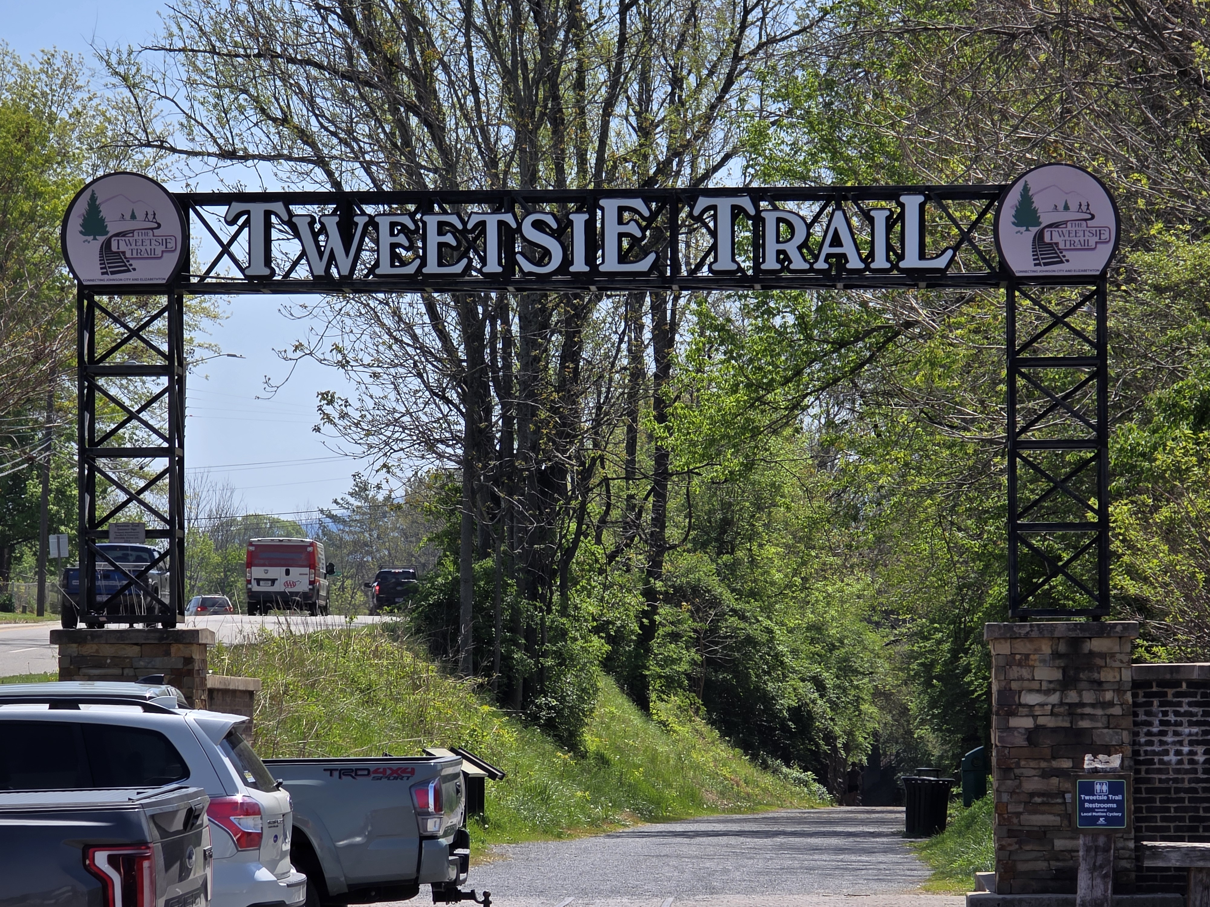
Tweetsie Trail

 At just under ten miles, the Tweetsie Trail is short for cycling but well loved in the communities of Johnson City and Elizabethton, TN. I rode in mid-April 2025 and started in Elizabethton where there was a gravel parking lot and a port a potty. The trail passed an industrial area, center city and retail strip malls. These are not my favorite views but after about 5 miles the trail became shaded and surrounded by trees and gaps with great views. I very much enjoyed this second half, just wish it was longer. My total round trip mileage was just 19.6 miles.

Elizabethton trailhead (36.32574, -82.20528) has a lower elevation than Johnson City (36.31498, -82.33655). The trail surface was fine gravel over hard pack. It was a smooth, easy ride. There were road crossings on the Elizabethton end but only some very low traffic crossings on the Johnson City end.